|
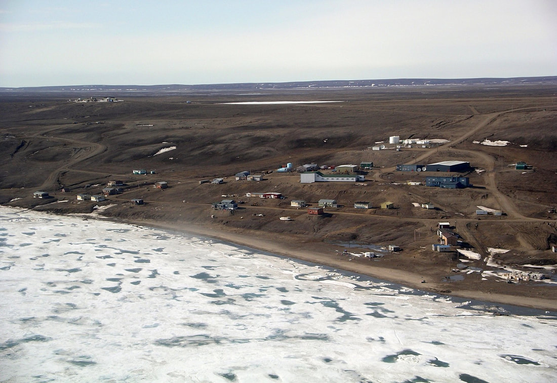
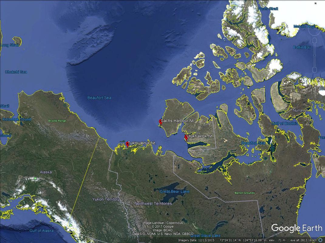
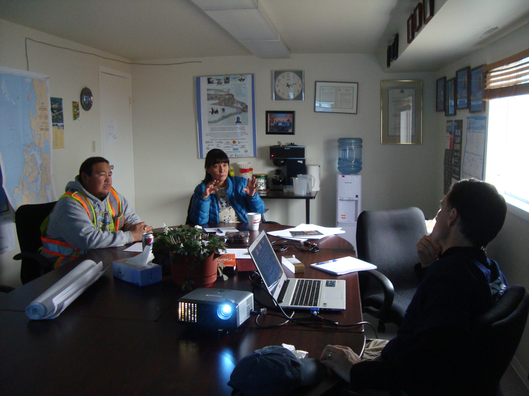
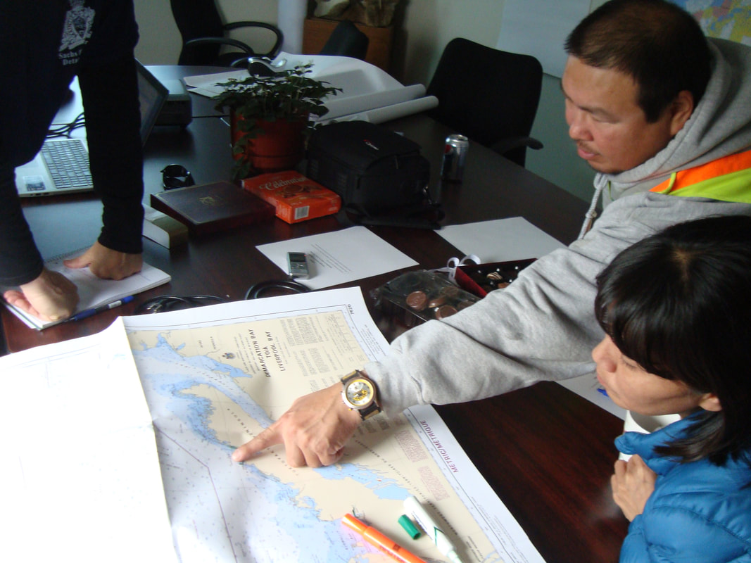
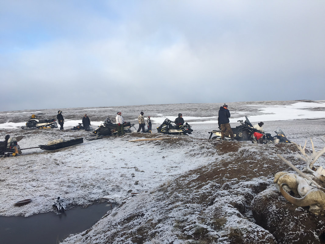
Dr. Laura Eerkes-Medrano, University of Victoria. Global climate change brings with it local weather that communities and cultures have difficulty anticipating. Unpredictable and socially impactful weather is having negative effects on the subsistence, cultural activities, and safety of indigenous peoples in Arctic communities. Since 2013, Professor David Atkinson and his team at the University of Victoria have been working with Inuvialuit communities in Tuktoyaktuk, Ulukhaktok, and Sachs Harbour. The main goal is to understand how impactful weather is affecting residents’ subsistence activities, particularly when they are on the water. The project involves site visits, interviews, and regular phone calls with residents. Inuvialuit residents regularly observe the waves, winds, snow, and ice conditions that interfere with their hunting, fishing, camping, and other subsistence and cultural activities. In this project, communities identify specific weather events that impact their activities. These events are then linked to the broader atmospheric patterns that cause them. Summaries of the events will be provided to Environment Canada to hopefully assist with the forecasting process. By taking this approach, the project links Western scientific knowledge and traditional knowledge to generate insights into how climate change is affecting Inuvialuit activities in the Canadian Arctic. An oversight committee has been established in each community to give direction to the project. This oversight committee includes representatives from each of the main community organizations, which ensures that the respective organizations provide direction to the project and advise on how to engage residents and communities. While the focus of the project is activities on the water, interviews with residents have shed light on a number of other impacts on their culture and subsistence activities. During a team’s site visit to Tuktoyaktuk in April 2016, the mayor, Darrell Nasogaluak, a member of the oversight committee, told me that “in the past, people were good at weather forecasting because they would observe the weather daily. Very few people today observe the weather as our forefathers did in the past, [who] would go out and look around and be able to predict the weather accurately. Now most people work Monday to Friday and only go out on Saturday and Sunday. Their only reference for what the weather will be like is the Environment Canada weather forecast, which is often not very accurate.” Since they have only two days for outdoors activities, residents often go out even if the weather forecast is not very good. Their weather observations consist of taking a picture. Darrell Nasogaluak mentioned that in the past, people would remember what the weather was like and make connections to how it was on the preceding days. Residents would think about changes in wind direction and try to understand these changes and link them to potential causes. “I would go out and I would ask someone what direction the thunders would be coming from, and they would know without looking at the window,” Darrell said. “Or I would ask when was the first storm this year and they would remember when it was in December. They would just have that knowledge. Now we go out and ‘click’ [take a photo] and don’t remember what it was like yesterday, and there is nothing to build on. That is how people are observing weather today.” On a larger scale, people have observed changes in timing and duration of storms. In Tuktoyaktuk, residents mentioned that big storms at the end of August and beginning of September are becoming more common. They cause stronger waves and affect their caribou hunt, as residents use their boats to go to the calving grounds at this time of the year. One resident, Rita Green, explained that stronger waves have forced her to take part in the seal hunt, while her husband handles the boat. In the past, “only men hunted for seals, and these roles are changing,” she said during an interview in 2014. She also mentioned that on July 8 2017, she and her family faced strong west winds on their way back from Hendrickson Island, where they were hunting belugas, to Tuktoyaktuk. She said that it was very hard to navigate the 19-foot boat that she and three other family members were on. “It was so windy that waves were coming into the boat,” she said, “and we had to throw out some mutkuk and meat” to keep the boat stable. During a phone call on July 8 2017, Vernon Amos, a resident of Sachs Harbour, said that spring 2017 camping activities in Egg River, which traditionally take place in May, were affected both by a lack of snow on the ground and by rivers running high with melt water. He added that winter blizzards were formerly not that common, but this past winter the community experienced one blizzard after another, and larger than usual amounts of snow. By the end of April, warmer temperatures and strong winds caused the snow to melt quickly, which made it difficult to go camping using a snowmobile. On the way back from camping, residents had a hard time crossing the rivers. In the past these rivers would have been frozen, but now they were running high with water from melted snow. Hunters in Sachs Harbour are concerned about the riverine erosion and permafrost degradation. As the permafrost dries it becomes very hard, which makes it difficult to travel by snowmobile. Another concern is the potential increase in tourism, particularly cruise ship activity, which could negatively affect caribou migration. On a positive note, the community’s fuel consumption during the winter of 2016 was 20 percent less than average, according to residents.
In Ulukhaktok, residents are concerned about the changes in winds and sea ice thickness. The sea ice used to form in October or November, but in the winter of 2016 it did not form until mid-December. With warmer temperatures the ice has less time to form, which makes it thinner and causes it to melt earlier. Residents used to go duck hunting, an important springtime subsistence activity, by driving their snowmobiles to cracks on the sea ice that ducks follow, and then driving another ten miles to gather duck eggs. One resident recounted how his father would take the snowmobile in July to go duck hunting. Now residents feel lucky if they can still use snowmobile for this activity in June. In 2017, residents had to take their boats instead. Storm winds are also getting more intense. Where residents used to experience 30 to 50 km/h winds during storms, now the winds are reaching speeds of 50 to 70 km/h. People need to take more precautions while traveling. If the wind starts to blow while they are traveling by snowmobile, the sea ice can be very dangerous. Leads will open, and the east wind will take the ice away from the shore. according to residents interviewed during the spring of 2016. There is now a great deal of information on how weather and in turn weather trends affect Inuvialuit activities on the water. This project is revealing that the impact of changing weather patterns is also felt across cultural and subsistence pursuits, and residents of the Arctic are having to adapt. Climate change is already affecting Inuvialuit lives in profound ways. This project was funded by the Marine Environmental Observation Prediction and Response Network (MEOPAR). “Lighthouses in the Empire”: History of Ice and Place in the “Mountains of the Moon”, Uganda9/4/2017
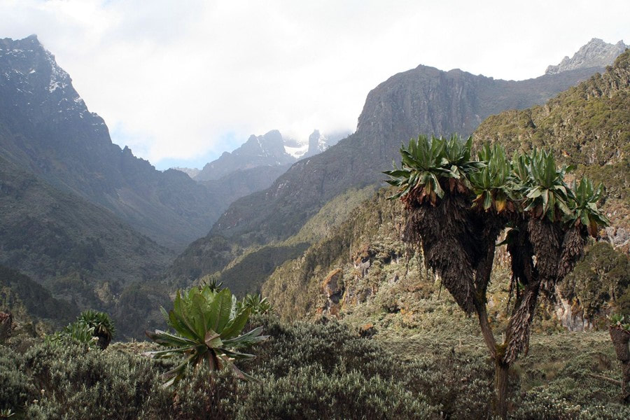
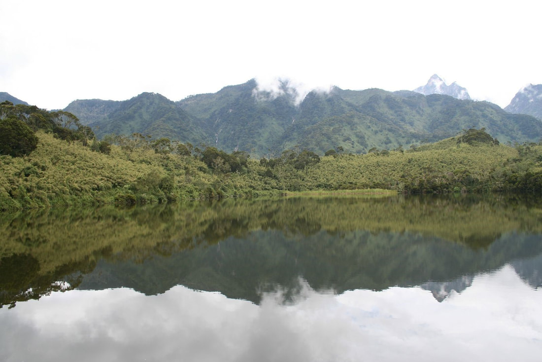
Christopher S. Kelly, Brown University, The Dwight-Englewood School. The Lukonzo word [spoken by the Bakonzo people] for their place, Rwenzururu, first misheard and mis-transcribed by H.M. Stanley in 1889, means the Place of Snow; and whether it is the reality or the symbol, Nzururu, snow is and remains the presiding deity. Mount Emin. Mount Baker. Mount Stanley. It is rare for a location to excite so many disparate sensibilities, but the post-colonial scholar, glaciologist, botanist, and climate scientist find themselves welcome bedfellows in the Rwenzori Mountains in tropical central Africa, straddling the border between Uganda and the Democratic Republic of Congo (DRC). Even as far afield in time and space as ancient Greece, philosophers trafficked in rumors that the Nile Headwaters hosted Ptolemy’s snow-capped “Mountains of the Moon.” Equally famous today is the gigantism reached by floral species of heathers, senecios, helichrysums, and lobelias — some reaching heights of 12 meters. Though far-flung from Eurasian loci of global power and empire, the mountains were named in ways that emblemize the crossroads of colony and metropole, from the brutal journalist-colonist Sir Henry Morton Stanley to Emin Pasha himself. More recently, the Rwenzururu separatist movement has been arguably the most persistent such conflict in post-colonial Africa. In this piece, I will illuminate the cultural significance of the mountains and glaciers within African and European history to contextualize the deep impact accompanying today’s rapid climatic changes. Admittedly, my motivations were aroused by close proximity to scientists presently working on the Rwenzori glacial and climate history—specifically, by a recent study just this year, which suggests that the scientific community may have grossly underestimated potential temperature change over these high mountains under current global warming (Loomis et al., 2017). The Roads to Rwenzururu Histories in brief are precarious enough to begin on most continents, let alone our ancestral birthplace. But here, it suffices to relay the most recent peopling of the Rwenzori region, its foothills, and the Semliki Valley in the modern eastern Democratic Republic of the Congo (DRC). Beginning in the 7th century and continuing to just prior to the colonial period, waves of emigration out of the Sudan populated the Semliki Valley. Subsequent migration to the mountains seem to have coincided with environmental pressures, for example in the 1880s and 1890s when disease, drought, and state-level violence plagued the Semliki. Indeed, contrary to early colonial musings, the isolation of the modern Bakonzo people—the predominant tribe on the eastern flanks of the Rwenzori— is not ancient, but was instead prompted by an ascendant Toro state propped up by British colonial rule (located east of the mountains) and the massive loss of life due to warfare and disease in the Busongora plains and the Semliki Valley (adjacent lowlands) (Syahuka-Muhindo, 2007). Today, the Bakonzo people primarily farm the eastern slopes. This practice signifies a split between the Bakonzo and other denizens of the Lakes region. Indeed, the economic consequences constitute one lens through which to understand the eventual unrest of the 20th century. One can trace the divergence back to the emergence between 800 and 1300 CE of specialized herding and banana cultivation in the Great Lakes region. These revolutions may have had an environmental origin, because dry periods would have forced pastoral productivity out of otherwise marginal land (Pennacini, 2007). Subsequently, new modes of production translated into farmer-herder client relationships for much of the broader Lakes region save the Bakonzo, Banande, and other nearby groups for whom the high altitude was not conducive to pastoralism. When the British Protectorate of Uganda resurrected the Kingdom of Toro, the Bakonzo people were reluctant to enter the de facto monetary economy in a subservient position, and tensions flared. In combination with rampant disease in the early 20th century, a crippling British tax system, and exclusion from advancement within scholastic colonial education, conditions deteriorated to the point where Bakonzo gave flight. This exodus led many across the border to the Belgian Congo—a chilling punctuation mark given King Leopold II’s rightly earned infamy as purveyor of mass terror and slave-based economy in the Congo Free State (Hochschild, 1999). When the situation in the Rwenzori became untenable, the Bakonzo rebellion broke out against the Toro polity in the 1920s and 1960s. This culminated when the Rwenzori peoples unilaterally declared independence from Uganda in 1962 (Pennacini, 2007). More than Mountains For imperialists setting their eyes on them for the first time, the Rwenzori mountains prefigured into an already circumscribed map of geographical, cultural, and racial mythos. In the voracious Zeitgeist of late 19th century colonial ambition, the search for the mythical “single origin” of the Nile River became a quest not only to solve a long-standing geographical mystery, but to identify the origins of Western civilization (Wittenberg, 2007). Simon Schama clarifies that “rivers took on metaphor and coursed “as lines of power and time carrying empires from source to expansive breadth”(Schama, 1995). When Henry Morton Stanley “discovered” the Rwenzori mountains in 1888, he took great scientific pains to show that they were indeed the primeval source of the Nile, and couched even their cultural surroundings within ancient Egypt. This would be an inexplicable falsehood without the context of European conceptions of Africa as a world apart, dark and barren and uniquely outside of civilization, and the mythological backstory in which the Rwenzori were already, in the minds of learned Europeans, connected to their own cultural development in antiquity. In other documents from the time period, “white snow” in “Darkest Africa” (the title of Stanley’s reports documenting his traverse) was irreconcilable without invoking separate geographical and cultural provenance (Stanley, 1890; Wittenberg, 2007). The first European woman to reach the alpine zone, Ruth Fisher, described Rwenzori as “the one unsullied and impregnable witness of holiness and purity to God, in a land where darkness has reigned, and the storms of passion, vice, and barbarity have laid desolate” (Fisher, 1919). To Fisher, and many in the colonial project, the mountains represented superior benevolence and nobility, concordant with Europe and European ideals (Wittenberg, 2007). Others related the cooler temperatures and grassy fields of the alpine environment more explicitly to good health —for Europeans, that is. A prominent work of colonial fiction from 1906 by the British politician, colonialist, and author John Buchan imagines that “[mountains] will be what Simla is to India, the workshop of government…they are in another climate, and give a tired man the moral and physical tonic he needs” (Buchan, 1906) Another passage from the same work expounds that: If only each hot country had been given a habitable mountain, they would be the only places in the world to live in. On the ordinary upland you dominate the flat country because you are higher up, but here we also look down on the plain because we are wholesome and cool and sane and they are fevered. We are a lighthouse to the whole of Equatoria, and if there were fifty other lighthouses in the Empire there would be no tropical problem. (Buchan, 1906) Conversely, for the inhabitants of the mountains, the symbolism is equally poignant, but unsurprisingly occupies a wholly different cosmology, focused on spirituality and fertility. The word Rwenzururu itself means roughly “the place of snow,” and some Bakonzo interpret the ice as the frozen sperm of the mountain-dwelling god Kitasamba (Pennacini, 2007). Central to this belief system is the fertilization of Earth and Konzo society by the yearly snowmelt (Pennacini, 2007). As such, the icy mountains themselves are inseparable from Bakonzo belief systems, especially their embitha —"that unspoken sense of unity and uniqueness” (Stacey, 2007). For those who have worked in the mountains with the Bakonzo people, it is easy to testify to the sanctity conferred on the snowscape. Brown University paleoclimate scientist Jim Russell explained to me that: Each time we visit the mountains our Bakonzo guides explain to us the rules of the mountains which are imbued with a respect for the space. No pointing, no whistling, no singing. Rules are especially strict when it comes to water: no bathing, and many times when we have gone out on a lake in a boat our guides will offer food to the waters. (Russell, 2017) 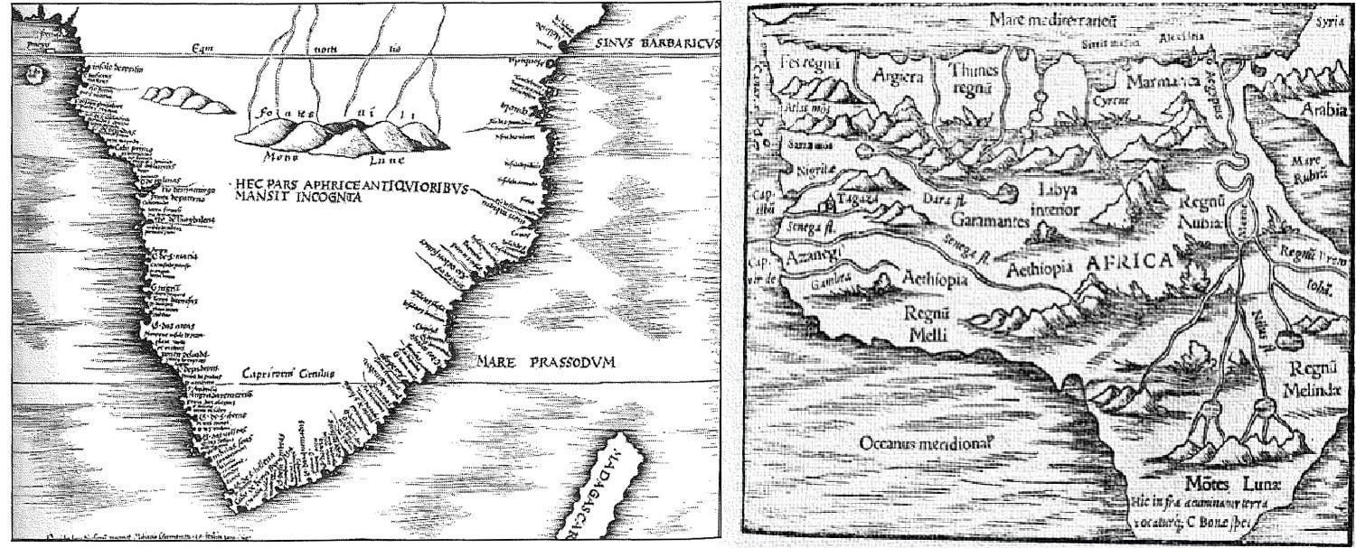 Two historical European depictions of Africa showing the Rwenzori before it was actually spotted by Europeans. On the left from 1513, Martin Waldseemuller shows the Greek-fabled Mountains of the Moon giving rise to the more northerly African rivers as the only geographic feature in “Dark Africa” (citing interpretation from (Wittenberg, 2007)). On the right is a reproduction (of unknown year to this author) of Ptolemy’s figure included in "Geographia." In this work, much of North Africa is complete, if incorrect, including the then-hypothesized Mountains of the Moon. It is intriguing to compare/contrast these maps in their detail and degree of conjecture. Ice in Retreat But the natural state of the region is in dramatic flux, primarily a result of human activity. These mountains, which loom over 5,000 meters (well over 16,000 feet), host equatorial glaciers that are in rapid decline; since 1900, East African glaciers have lost over 80 percent of their surface area (Hastenrath and Kruss, 1992; Thompson, 2002). The full social and natural ramifications of this loss are still not clear, but they could well be disastrous. Firstly, modern foreign tourism revolves around ice climbing and observing the glaciers. In 1991, the Rwenzori Mountains National Park was established, and the Bakonzo were banned from hunting in the mountains by the Ugandan state. In “exchange” for these restrictions, guides and porters for tourists entering the mountains were to be hired solely from the local communities on the mountain slopes, chief among them the Bakonzo (Russell, 2017). The disappearance of the glaciers may impact tourism in ways that call this agreement into question. Secondly, glacier retreat is known to strongly impact water resources in some mountain glacier regions, such as the Andes (Baraer et al., 2012; Mark, 2008; Mark et al., 2010). Glaciers act like a dam, accumulating snow in the wet season and releasing it as meltwater in the dry season. This buffers against strongly seasonal flows. Glacier retreat in the Andes is associated with an increase in the seasonality of river flows and a slight increase in the mean flow rate (due to the melting of “ancient” ice). Recent research suggests that snowmelt may not impact local river flows that provide water to indigenous communities as much as it has in the Andean highlands (Taylor et al., 2009); nevertheless, changes to the alpine lakes and surrounding ecosystems are likely to occur given the combination of melting ice and warming (Panizzo et al., 2008). Finally, local environmental risks, such as slash-and-burn techniques, exacerbate threats to an ecosystem already fragile to climate change, and pose a barrier to ecotourism endeavors. Recent disasters drive this point home, such as the fire outbreak on Mt. Rwenzori in 2012 and the subsequent Kilembe Flood of 2013 (IFRC, 2014; Misairi and Ninsima, 2012; UNESCO, 2012). In this case, the wildfires in the alpine zone weakened the water holding capacity of the upper mountain valleys, which then flooded into the lowlands during the next rainy season. In sum, this environmental “moment” and the future of the Rwenzori motivates scientific efforts to probe geological, glaciological, and historical records for patterns that have governed the history of ice and environment in the Rwenzori. Learning from Past Climate Change The last instance in Earth history to experience appreciable changes in temperature with rising CO2 was during the global thaw following our Earth’s most recent glacial time (~20,000 years ago continuing into the earliest Holocene ~11,000 years ago) (Clark et al., 2012), making that time slice a potentially helpful scientific analog. The Rwenzori Mountains are no exception. Moreover, scientists are interested in specifically how the past local climates and glacier extent of tropical high-elevation belts differed from the present under different background climatic conditions, and what lessons we might glean from those dynamics under the future regime of persistent global warming. Accordingly, scientific teams are actively working to understand both Rwenzori environmental change during across the “deglaciation” (warming following the glacial state), as well as the last glacial climate itself to probe differences that may inform understanding about the future (albeit a different sign of temperature/climate change). . To study such past climates, scientists build “proxy” climate archives to reconstruct the extent of ice, but also the factors behind glacial expansion, namely temperature (cold) and precipitation (dry). Similarly, glacial retreat can result from warm temperatures or regionally wet episodes, or some combination thereof. Studies of Rwenzori glacial moraines—accumulations of glacial debris—as well as lake sediment records suggest that ice expanded during cooler and drier conditions at the same time as Earth’s last glacial maximum (Kelly et al., 2014). A new high-profile publication by Loomis et al. (2017) based on geochemical reconstructions of past lake temperatures at multiple elevations has revealed that this cool time was enhanced in the Rwenzori via amplified cooling with elevation during this global glacial maximum. Uncovering recent changes in glacial extent has been perhaps even more fraught, since investigation requires deconstructing the colonial archive and the assumptions embedded in it—which even when approximately accurate, lack a long-term perspective. For example, the present episode of glacial retreat had been thought to commence in ~1880 due to the waning wet period in the latter half of the 19th century in the Great Lakes region, as well as the legacy of colonial observation, which intensified in the late 1880s (Hastenrath and Kruss, 1992; Mölg et al., 2003). But in 2008, a research group found that siliciclastic material in lakebed sediments across the Rwenzori region correlated with the glaciation of those lakes (Russell et al., 2009). Because siliciclastic content was more or less stable from 1200 until 1870, the scientists concluded that for multiple centuries, fluctuations in ice have been relatively small in comparison to those experienced today (Russell et al., 2009). In this way, the European records of shrinking ice are not at all indicative of “normal” conditions over the 800 years. Finally, the timing of initial retreat is crucial; 1870 falls in a regionally wet time in the Rwenzori, suggesting that assumptions about the timing of glacial retreat in the region made on the basis of late ninteteenth-century observations are inaccurate. 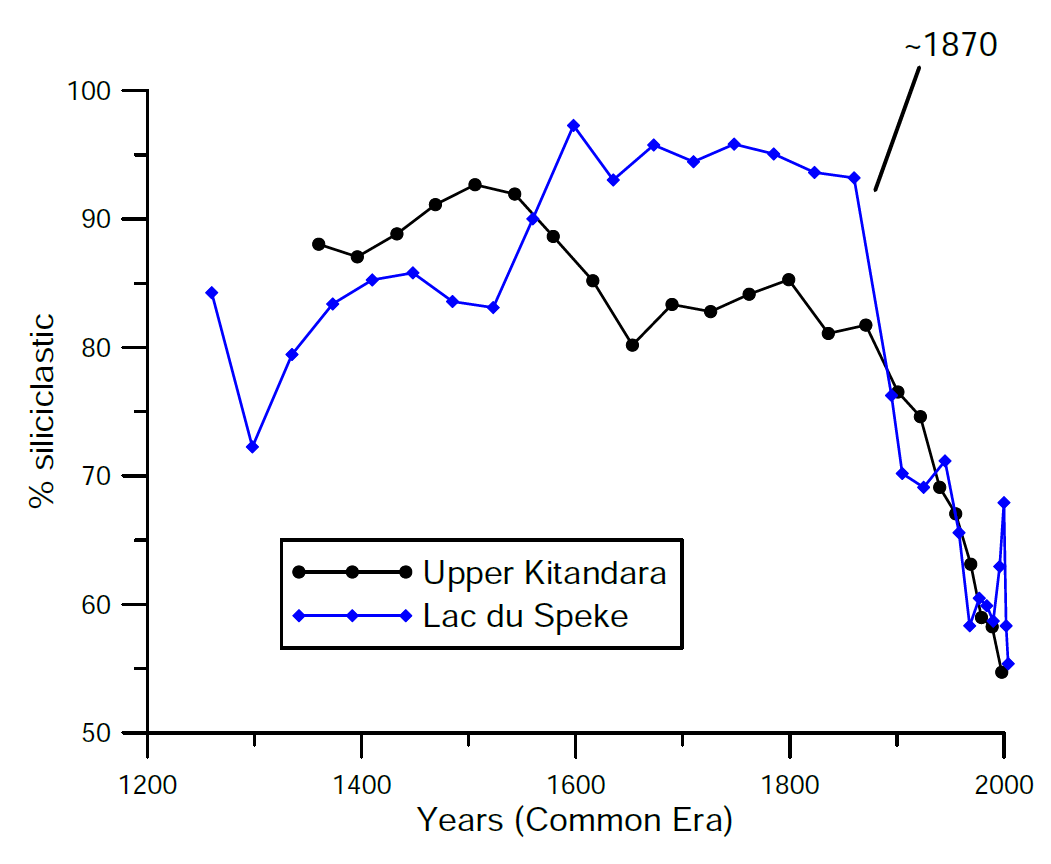 Replotted %siliciclastic data from Lakes Upper Kitandara and Lac du Speke, with permission. As a proxy for the extent to which a lake was glaciated, these records depict relative glacial stability in the centuries leading up to the present decline beginning ~1870 (fluctuations in the early part of the last millennium should be interpreted with caution; see original scientific work). (Russell et al., 2009) Taken altogether, some consensus is emerging that Rwenzori glaciers are melting today mostly as a result of rising air temperature. A recent study has revealed that temperatures in the tropics increased more dramatically at high elevations compared to low elevations during the last glacial maximum (Loomis et al., 2017). If we can expect the same today, in our warming world, it would spell amplified warming in the high-altitude Rwenzori mountains—warming that the glaciers likely cannot withstand. Indeed, a prominent study of ice core records from Kilimanjaro gives tropical African glaciers only another ten years (Thompson, 2002). Conclusion: Snow-Capped No More An essay on the Rwenzori in the Western imagination concludes: Ironically, the hopes of local Rwenzori communities are not only linked to the return of peace [following conflict in the Great Lakes region], but also a continuation of colonial myths about the Mountains of the Moon. In order to draw tourists and attract development, the Rwenzori will in all likelihood continue to be inscribed with a Western history that obscures local cultural knowledge, traditions, and histories.” (Wittenberg, 2007) Climate change may call this obfuscating history and the tourism it promotes into question. As time passes, the disappearance of the glaciers will render Stanley’s “lofty mountain king, clad in its pure white raiment of snow” a more distant memory (Stanley, 1890). Just what this portends for Bakonzo cosmology, mountaineering, and tourism is today unclear. Yet it is no small irony that modern Rwenzori could face grave climate challenges from the conquest, dominion, and industrialization of the world by the Global North—the same processes that gave rise to a dependence on foreign capital in the first place in this unique mountain kingdom.
|
Archives
March 2022
Categories
All
|


 RSS Feed